Badger Lake in Mt. Hood National Forest, was quite dry when I was there at the end of the summer. I might try to get back this winter if the roads are open. Ice skating anyone? 🙂

Badger Lake in Mt. Hood National Forest, was quite dry when I was there at the end of the summer. I might try to get back this winter if the roads are open. Ice skating anyone? 🙂

I looked and looked, but did not see a one. Not even any tracks or other signs. Sigh. Maybe next time. A badger is one of the few mammals that I have not seen in the wild.
My painting shows a view the campground at Badger Lake in Mt. Hood National Forest; west of Portland, Oregon. It was from my September trip. Check out the story; a couple of blog posts back. The red bushes are very dried out huckleberry plants.
Enjoy!

Come along on another short trip to Mt. Hood National Forest; west of Portland, Oregon. This trip (Oct 2018) was to Keeps Mill on the White River on the southeast side of Mt. Hood. High clearance, 4-wheel-drive, and narrow vehicle all came in handy – more later.
Trip Highlights


The campground is at the bottom of a deep gorge carved out by Clear Creak (from Clear Lake) and the White River (from White River glacier). Clear Creek flows into White River at the campground. The last mile of Forest Road 2120 is a fairly rough road that switchbacks down the side of a steep hillside with 100+ foot drops to Clear Creek below. It was a road with a “view”. It made for some exciting moments. I didn’t take any photos because slopes never look as steep in a photo as they do in real life. I learned that from my mountaineering days – incredible to be there, but lame in photos.
The campground is scenic, woodsy style. No wifi or cell signal here. Wonderful. Every campsite is spacious, fairly flat, and next to the river, with tall pines all around. I was the only person there. However, it was definitely not quiet. White River, about 40 feet away from my camp, was a constant roar. Even though the sun was still up, the camp was shaded and cool – jacket required. I explored the campground and read the historic marker to kill time before dinner and bed. There were not any signs of wildlife except for the occasional bird and errant chipmunk.
Dinner was a small smoked salmon filet and wine. It was too chilly to sit outside without a fire so I “went to bed” about 7 pm – it was already dark and getting colder so I set up my new propane heater (mrheater) inside by Jeep Liberty, where I sleep FYI. The heater shuts off if it tips over or if oxygen level gets too low. Obviously it worked, but I still cracked the windows for some ventilation just in case.
There was enough battery life on my iPad to keep me occupied for awhile; I didn’t want to go to sleep too early. But settling down at 7 pm has a major problem. At some point, one will have to get up to relieve oneself (twice). I turned the heater on for awhile, as a test, but it was a bit too warm. I turned it on again for good at about 1 am or so and it was still going when I woke up about 8:30 am. I was comfortable, but not overly warm as I awoke to sun streaming though distant trees. It was plenty cold outside of my little jeep, though.

Morning. I made coffee, boiled in my percolator coffee pot. Very nice. Some day I will have to experiment to see if camp coffee is really better than home coffee. It was too cold for yogurt so breakfast was a banana and a bite of fresh beef jerky. I packed up and planned to drive to nearby Little Crater Lake. I was not looking forward to the first mile of my drive, the narrow, exposed part.

As fate would have it – about half way up the first bit of road, the most exposed and narrowest stretch, I met a truck coming downhill. Backing up was not a desirable option for either of us. So, he got as close as possible to the outside edge of the road (the exposed side) and I drove my left wheels up onto the inside rock hillside, tilting slightly to the right. Crazy, but I was thankful for 4WD and a narrow vehicle.
The rest of the trip was mostly uneventful, except for the part, way off road again, where I thought my transmission quit working (another story to be discussed with my mechanic). Little Crater Lake was beautiful; a must-go if you live nearby. The lake is clear and fairly shallow and you can see all the way to the bottom.
Thanks for joining me.
FYI: The salmon and jerky were from http://meatingplacepdx.com. I don’t get anything for free from them, but they are a local butcher shop so I wanted to give them a mention.
Next trip: Plan is for November. Any suggestions for Oregon or Southern Washington National Forests?


My journey into the wilderness
Note: I will add my drawings from this trip to my Artwork page and I will also share some of them on Instagram (@michaelliebhaber)
Trip Highlights

I took a short trip last week to Badger Lake on Mt. Hood (Oregon, USA). My friends came along for company. Badger Lake is one of the few (the only?) wilderness campgrounds to which one can drive on the mountain. It’s a remote, small, spring-fed lake at 4400 feet (1340 meters). The main feature, at least in my opinion, is psychological: I encountered no one on my drive to the lake. When I stopped my Jeep (2003 Liberty 4WD) I was struck by the silence. There was no noise, none. There were no people, no cell service. I was alone.

I took the road less traveled, the short cut, which requires a high clearance vehicle for the entire 14-ish miles. Most of the road is rough natural terrain (rocks embedded in soil) with some pure rock stretches (scree or talus) and clings to steep mountainsides.
Trees lined the road in most places, however, there were a few exposed parts; places where there were no trees below me, the road was just wide enough for my vehicle, and with very steep 200-300 foot drop offs below. And then there were the scary bits! Overall, it was a punishing drive on my vehicle and me.
I arrived at the campground just before dark, exactly 100 miles from my start at Scappoose. I selected a spot that had a peek-a-boo view of the lake. I slept in my jeep – water proof, bug proof, bear proof, and (almost) big enough for me. I awoke to find that the setting was very pleasant. The lake was only about 1/3 full because of the dry summer and evaporation. Some people came to kayak in the early morning, but I think they were deterred by the mud surrounding the water. The only wildlife I saw were birds, chipmunks, and an occasional squirrel. Deer and horse tracks crisscrossed the area.
The photos below are at the campsite and the lake.


I took the recommended route out (26 miles). Much nicer. I think I saw my jeep smiling. I decided to camp at Trillium Lake. My spot in the tent camp area was a one minute walk from one of the most photographed views of Mt. Hood, so I took picture! The next day I drove up to Historic Timberline Lodge, where I took the close-up photo of the mountain – the one with my traveling companions! They were disappointed. The Forest Service Ranger said they could not climb the mountain because they did not have the proper equipment. My little friends argued that, because they were animals, they did not need equipment. The Ranger countered that real animals don’t talk and are not stuffed. At which point Foxy attempted to bite the Ranger because “That’s what animals do.” Thus ended my visit to Timberline Lodge and Mt. Hood.


Walking among old Fir trees in Scappoose, Oregon
8in x 10in / Watercolor & Ink / 2018
Story: These tall, old trees are near the airport; very grand. As I noted before, the land is for sale.
All content © copyright 2005-2018, Michael J. Liebhaber

Old Fir trees in Scappoose, Oregon
8in x 10in / Watercolor & Ink / March 2018
Story: These tall, old trees are near the airport; very grand. I will hate to see them go – as I noted before, their homeland is for sale.
All content © copyright 2005-2018, Michael J. Liebhaber

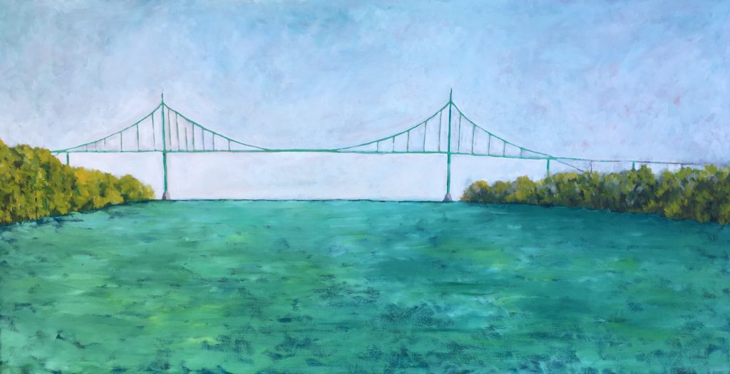
View – St. John’s Bridge
48in x 24in / Oil on Panel
2018
All content © copyright 2005-2018, Michael J. Liebhaber

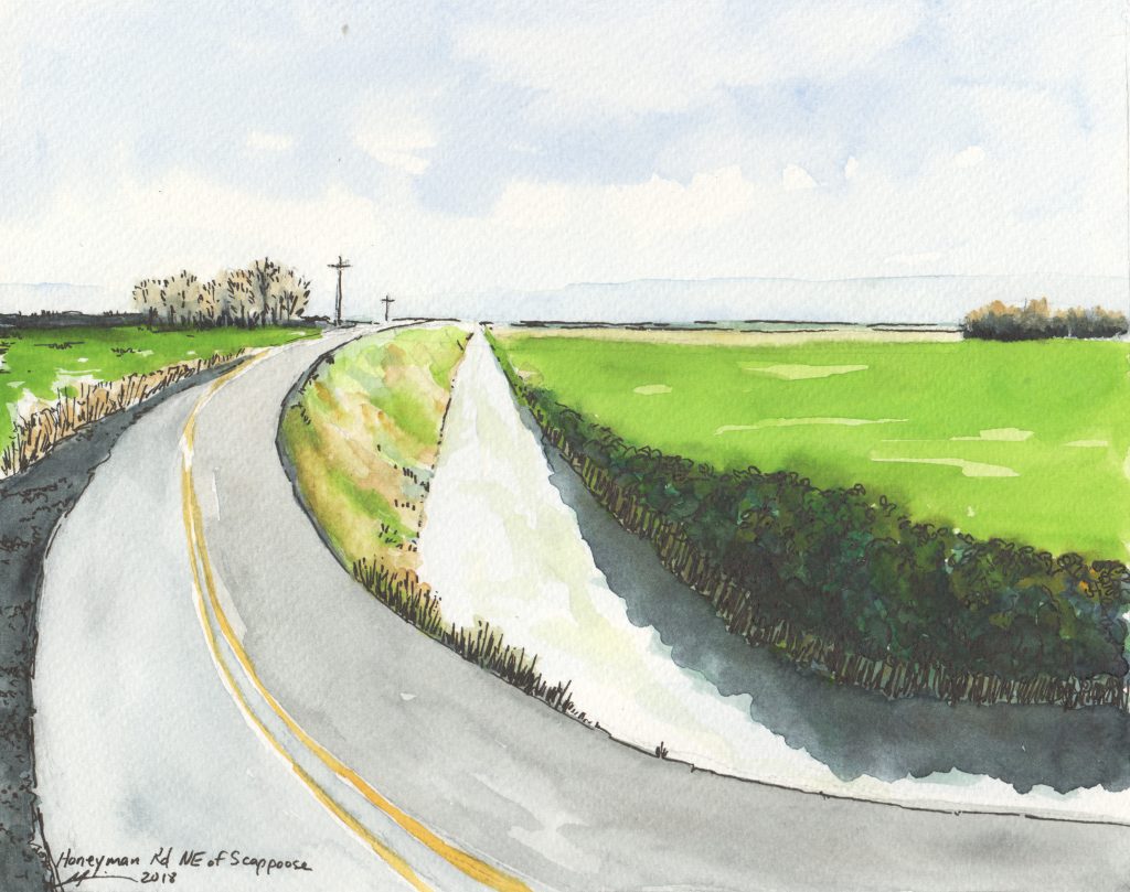
Farm Drainage Ditch: 45.8, -122.8
8in x 10in / Watercolor & Ink
February, 2018
Story: One of many farm ditches near Scappoose. This one is along East Honeyman Road.
All content © copyright 2005-2018, Michael J. Liebhaber